The Punjab Forest Department's detailed satellite imagery analysis shows minimal damage from recent forest fires in Kotli Sattian and Kahuta.
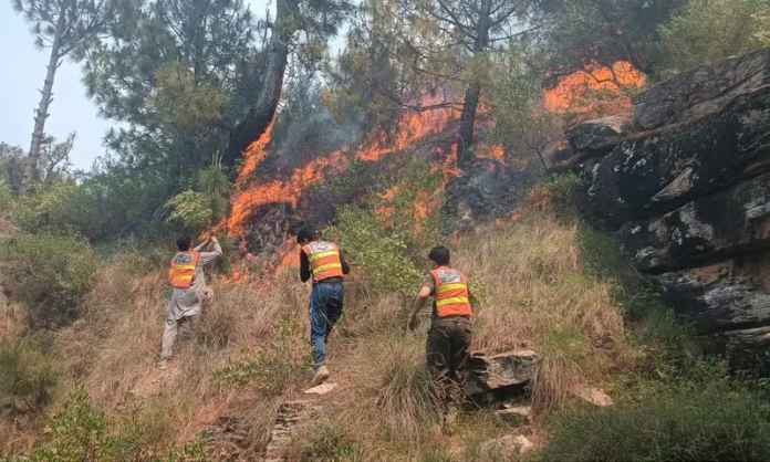
The Punjab Forest Department has conducted a comprehensive assessment of the recent forest fire incidents in Kotli Sattian and Kahuta using Sentinel-2 satellite imagery. According to the findings, the impact of these fires was limited, indicating that local ecosystems may recover more quickly than initially feared.
The assessment covered an extensive area affected by the fires, providing detailed insights into the extent of damage. While the forest department acknowledged the presence of active fire spots and areas where vegetation had been severely impacted, the overall impact was found to be less severe than initial reports suggested. The satellite imagery allowed for a precise evaluation of burned areas, unburned patches, and the recovery potential of affected regions.
Local conservationists have welcomed this news, as it suggests that efforts to control the fires were effective in mitigating broader environmental damage. However, they caution that ongoing monitoring is necessary to ensure long-term ecological stability. The forest department plans to continue working closely with local communities and environmental organizations to restore damaged areas and prevent future incidents.
This assessment highlights the importance of using advanced technology like satellite imagery for accurate fire management and environmental monitoring in Punjab's forests. It also underscores the need for continued vigilance and proactive measures to protect these vital natural resources.