

Weather Advisory: Monsoon Rains Expected Across Pakistan
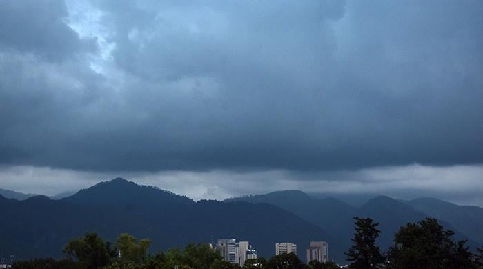
The Pakistan Meteorological Department (PMD) has issued a weather forecast indicating the commencement of widespread rainfall throughout the country, starting today, due to the active monsoon season.
According to an official statement from the Met Office, moisture-laden air currents are currently entering Pakistan and are anticipated to gain strength starting July 13. Additionally, a new westerly weather system is projected to approach the region by the evening of the same day.
These weather patterns are expected to result in widespread rainfall, accompanied by wind and thunderstorms, across various regions of the country, with the possibility of intermittent heavy downpours.
Regional Forecasts:
- Kashmir and Gilgit-Baltistan: Expect rain-wind/thundershowers along with scattered heavy to very heavy rainfall in Neelum Valley, Muzaffarabad, Rawalakot, Poonch, Hattian, Bagh, Haveli, Sudhanoti, Kotli, Bhimber, and Mirpur between July 11 and 17.
- Gilgit-Baltistan: Diamir, Astore, Ghizer, Skardu, Hunza, Gilgit, Ghanche, and Shigar are likely to experience rain and thunderstorms with isolated heavy falls on the night of July 11 and from July 13 to 16.
- Khyber Pakhtunkhwa: Most districts, including Dir, Chitral, Swat, Kohistan, Malakand, Shangla, Abbottabad, Peshawar, Mardan, Nowshera, Bannu, D.I. Khan, and tribal areas like Bajaur, Khyber, Orakzai, and Waziristan, are expected to receive rain-wind/thundershowers with scattered heavy falls from July 11 to 17.
- Punjab and Islamabad: Widespread rainfall, including occasional heavy to very heavy showers, is anticipated in Islamabad, Rawalpindi, Murree, Attock, Lahore, Faisalabad, Sialkot, Gujranwala, Sargodha, and adjacent districts from July 11 to 17. Southern Punjab areas, such as Bahawalpur, DG Khan, Multan, and Rahimyar Khan, are expected to receive isolated heavy falls today and again from July 13 to 17.
- Balochistan: Northeastern and southern parts, including Quetta, Zhob, Kalat, Khuzdar, Lasbela, and Dera Bugti, are likely to experience rain and thunderstorms with scattered heavy falls today and later from July 13 to 16.
- Sindh: Moderate rain-wind/thundershowers are expected in Karachi, Hyderabad, Larkana, Sukkur, and other districts from July 15 to 17.
Potential Hazards and Warnings:
The PMD has cautioned that heavy to very heavy rainfall may lead to flash flooding in local streams and nullahs of Murree, Galliyat, Swat, Dir, Kohistan, Abbottabad, Islamabad, Rawalpindi, and parts of northeast Punjab, Balochistan, and Kashmir from July 14 to 17.
Additionally, urban flooding is a risk in low-lying areas of Islamabad, Rawalpindi, Lahore, Gujranwala, Sialkot, Sargodha, Faisalabad, Nowshera, and Peshawar between July 13 and 17.
The Met Office also indicated that hilly regions of Khyber Pakhtunkhwa, Murree, Galliyat, Kashmir, and Gilgit-Baltistan could experience landslides or mudslides, potentially causing road closures.
Strong winds and lightning may also cause damage to vulnerable structures, electric poles, billboards, vehicles, and solar panels.
Advisory for Public and Authorities:
The PMD has advised farmers to plan their activities accordingly and urged travelers and tourists to avoid unnecessary travel to vulnerable areas. Relevant departments have been instructed to remain vigilant and implement precautionary measures to mitigate potential risks.
NDMA Alert:
The National Emergencies Operation Centre (NEOC) of the National Disaster Management Authority (NDMA) has issued a hydrological outlook and impact-based weather alert for July 13-17, highlighting the potential for flooding and significant rainfall in various regions.
The NEOC reports that moderate to heavy monsoon rains are anticipated due to increased moisture from the Bay of Bengal and the Arabian Sea, combined with an approaching westerly wave. This is likely to increase flows in the Indus, Kabul, Jhelum, and Chenab rivers.
Currently, Tarbela, Taunsa, and Guddu barrages are at low flood levels, while Kalabagh and Chashma are at medium flood levels. Taunsa Barrage is expected to reach a medium flood level during the forecast period.
The River Chenab at Marala and Khanki, and the River Kabul at Nowshera, are projected to reach low flood levels.
Swelling is anticipated in the Swat and Panjkora rivers, including tributaries. Hill torrents of Dera Ghazi Khan and Rajanpur in southern Punjab may reactivate, potentially reaching medium to high flood levels.
High flows are expected in streams and nullahs in northeastern Balochistan districts, including Jhal Magsi, Kachhi, Sibi, Qila Saifullah, Zhob, and Musakhel. Localised flash flooding is possible in river networks of southern Balochistan, such as Khuzdar, Awaran, Lasbela, and Qalat.
Tarbela Dam is currently at 74% storage capacity, and Mangla Dam is at 44%.
Safety Measures and Recommendations:
- Residents near rivers, streams, and nullahs should remain vigilant, especially during heavy rains and at night.
- Communities in flood-prone areas should identify safe evacuation routes, move valuables and livestock to higher ground, and prepare emergency kits with food, water, and medicine for three to five days.
- District administrations, especially in northeastern and central Punjab, are directed to ensure dewatering equipment is ready for urban flooding.
- The public is urged to stay updated via official flood alerts on television, radio, SMS, and the Pak NDMA Disaster Alert mobile application.
- Avoid crossing low-lying bridges, causeways, and flooded roads during the forecast period.
The NDMA has affirmed its close coordination with relevant authorities to monitor the situation and issue timely alerts.
Comments (0)
No comments yet. Be the first to comment!
Leave a Comment